In summary:
- Choose your side of Line 1 (University vs. Yonge) based on your final destination and time of day to avoid chokepoints.
- Survive rush hour at major interchanges like Bloor-Yonge by mastering “interchange choreography”—knowing where to stand on the platform and which car to board.
- Calculate your true commute time by adding buffers for walking, waiting, and potential delays, not just the listed travel time.
- Use the underground PATH system strategically by following landmark-based routes, like the “food court method,” to navigate from Union to the Eaton Centre.
Navigating the Toronto subway feels like it should be simple. After all, it’s mostly two lines: the U-shaped Line 1 (Yonge-University) and the cross-town Line 2 (Bloor-Danforth). Many guides will tell you to just get a PRESTO card, look at the map, and mind the gap. But every day, thousands of riders get caught in bottlenecks at Bloor-Yonge, add ten minutes to their trip by choosing the wrong side of the “U,” or emerge from the underground blocks away from their destination.
The common advice focuses on the what, not the how. It tells you that Bloor-Yonge is busy, but not how to slice through the crowd. It tells you there are weekend closures, but not how to outsmart the shuttle bus lines. Mastering the TTC isn’t about memorizing a map; it’s about understanding the hidden system rhythm and the underground physics of passenger flow. The key isn’t just knowing the route, but mastering the timing, positioning, and strategic choices that separate a stressful commute from a seamless one.
This guide dives into that strategy. We’ll decode the commuter’s geometry of Line 1, teach you the choreography for surviving the busiest interchanges, and show you how to calculate your commute time with the accuracy of a seasoned local. We will even venture into the city’s vast underground PATH network, transforming it from a confusing labyrinth into your greatest all-weather asset.
Summary: A Strategic Guide to Toronto’s Subway
- Why the “University Side” Is Faster for Financial District Access?
- How to Survive the Crush at Bloor-Yonge Station at 5 PM?
- St. George vs. Spadina: Which Interchange Is Easier to Walk?
- The Weekend Closure Pattern That Disrupts Line 1 Regularly
- When to Catch the Last Train Before the System Shuts Down at 1:Moving to Toronto: How to Navigate the Cultural Mosaic Without Overwhelm?
- How to Calculate Your True Commute Time Including Subway Transfers?
- How to Walk from MTCC to Union Station Without Going Outside?
- Navigating the PATH: How to Walk from Union to Eaton Centre Without Getting Lost?
Why the “University Side” Is Faster for Financial District Access?
The U-shape of Line 1 presents a daily strategic choice for downtown commuters: Yonge or University? A rookie mistake is treating them as equal. The truth lies in commuter’s geometry and timing. Your choice should be dictated by your final destination building and the time of day. While King and St. Andrew stations seem close, their underground exits serve different parts of the Financial District.
For destinations in the western part of the district, such as First Canadian Place or Scotia Plaza, taking the University side to St. Andrew station is unequivocally faster. The station’s PATH connections put you closer to these towers. Conversely, buildings like Commerce Court are more centrally located, making either King or St. Andrew a viable option, but one factor changes the entire equation: crowd dynamics.
Before 9 AM, the Yonge side platform at King station is a significant chokepoint. The platform becomes intensely congested, slowing your exit. The University line, by contrast, tends to have a more distributed passenger flow, allowing for a quicker escape from the station. The only time to reverse this strategy is during events at Scotiabank Arena. On game nights, the University line becomes saturated post-event, making the Yonge side the smarter, quieter choice for your journey home.
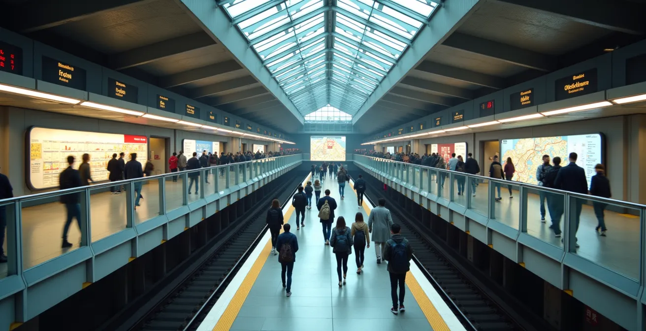
How to Survive the Crush at Bloor-Yonge Station at 5 PM?
Bloor-Yonge station is the heart of the TTC and, at 5 PM, its most clogged artery. With over a million people passing through on a busy day, simply showing up and hoping for the best is a recipe for a stressful commute. Surviving the crush isn’t about brute force; it’s about interchange choreography—a series of precise movements that begin before you even arrive at the station.
Experienced commuters practice platform positioning. If you’re on Line 1 heading southbound to transfer to the westbound Line 2, don’t just get on the train anywhere at Wellesley station. Board the front cars. This simple action aligns you perfectly with the escalators down to the Line 2 platform at Bloor-Yonge, letting you bypass the dense crowds clustered in the middle of the platform.
The same logic applies when coming from the east on Line 2. To transfer to southbound Line 1, position yourself in the rear cars when you board at Sherbourne. This places you directly at the foot of the transfer corridors, giving you a head start on the herd. It’s about anticipating passenger flow and using the station’s layout to your advantage. You’re not just waiting for a train; you’re positioning yourself for the next two moves in your commute.
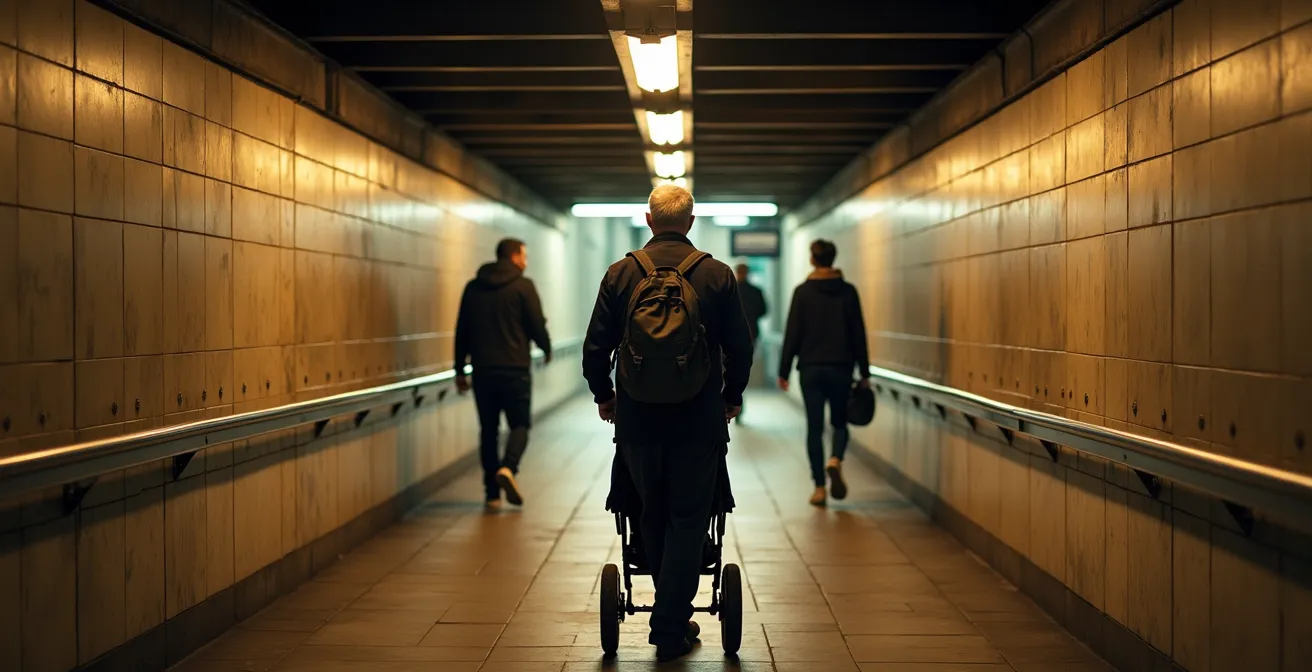
St. George vs. Spadina: Which Interchange Is Easier to Walk?
When transferring between Line 1 and Line 2 on the west side of the system, you’re faced with another strategic choice: St. George or Spadina. While they look close on the map, they offer vastly different physical experiences. Choosing correctly depends on your mobility, your luggage, and your tolerance for either stairs or long walks. It’s the classic vertical challenge vs. the horizontal marathon.
St. George station is the “vertical challenge.” The transfer requires navigating multiple levels, with a combination of stairs, escalators, and elevators. While elevators are available, making the station accessible, the transfer can feel disjointed as you move between floors. According to the TTC, they plan to have all stations fully accessible by 2025, but for now, the multi-level design at St. George can be a puzzle during peak times.
This image captures the feeling of the long transfer corridor at St. George, a key part of its “vertical challenge.”
Spadina, on the other hand, is a “horizontal marathon.” The two lines are connected by a very long underground tunnel. To mitigate the walk, there is a moving walkway, though its operational status can be unpredictable. When functional, it makes the transfer relatively painless and entirely step-free. For those with strollers, rolling luggage, or mobility devices, Spadina is often the easier, albeit longer, choice, provided you’re prepared for the walk.
The data on transfer times and congestion levels confirms this distinction, as shown in a comparative analysis of TTC interchanges.
| Transfer Point | Average Transfer Time (5 PM) | Platform Congestion Level | Alternative Routes Available |
|---|---|---|---|
| Bloor-Yonge | 4-7 minutes | Extreme | Limited |
| St. George | 3-5 minutes | Moderate | Multiple platform options |
| Spadina | 5-8 minutes (with moving walkway) | Light | Streetcar connections |
The Weekend Closure Pattern That Disrupts Line 1 Regularly
One of the core rhythms of the Toronto subway system is the weekend closure. Especially on Line 1, these disruptions for signal upgrades and maintenance are a regular feature of city life. Ignoring them will lead to frustration and long waits for shuttle buses. The key is to anticipate them and have a strategy ready. TTC documents reveal a predictable pattern, with as many as 22 full-weekend closures scheduled for 2024 alone.
These closures are almost always announced by Thursday evening for the upcoming weekend. The first rule of a savvy commuter is to check the TTC Service Alerts page or social media every Friday. This simple habit saves you from showing up to a shuttered station. But the real strategy lies in how you handle the shuttle bus replacement service.
Shuttle bus queues at major stations like St. George or Eglinton can be immense. The pro move is to walk one station over. If St. George is closed, walking to the less-crowded Museum or Spadina stations often means you’ll board a shuttle bus immediately, leapfrogging the long line at the main closure point. Furthermore, consider parallel surface routes. Express buses like the 142 on Avenue Road can be significantly faster than the stop-and-go shuttle buses navigating traffic.
Your Action Plan: Weekend Closure Survival Guide
- Check TTC alerts every Friday: Closures are typically announced by Thursday evening for work starting Saturday morning.
- Walk one station over for shuttle buses: During closures at busy stations like St. George, walking to Museum or Spadina stations often means shorter shuttle bus queues.
- Use parallel surface routes: The 142 Downtown Express on Avenue Road/University Avenue often runs faster than closure shuttle buses.
- Plan for 20-minute delays: Factor in additional travel time when shuttle buses replace subway service, especially for connections.
When to Catch the Last Train Before the System Shuts Down at 1:Moving to Toronto: How to Navigate the Cultural Mosaic Without Overwhelm?
The Toronto subway system has a firm bedtime. Service typically ends around 1:30 AM, with last trains departing from terminal stations. Missing that last train can feel like a disaster, but in Toronto, it’s just a transition. The end of subway service doesn’t mean the city shuts down; it means you switch to a different mode of exploration, one that can be surprisingly effective for experiencing the city’s cultural mosaic.
When the subway sleeps, the Blue Night Network awakens. This extensive network of late-night buses runs from roughly 1:30 AM until the subway restarts in the morning. These routes, often following the subway lines, offer a unique, uncrowded perspective on the city. For a newcomer, it’s a powerful tool. A journey on the 300 Bloor-Danforth bus, for instance, becomes a nocturnal tour of Toronto’s diversity, connecting you from the vibrant lights of Koreatown near Christie, through the Annex, and all the way to Greektown at Pape and the Danforth.
This diversity isn’t just geographical; it’s a sensory experience, a rich tapestry of cultures that can be visualized as a mosaic of textures and flavours found along the subway lines.

Using the Blue Night Network is more than a backup plan; it’s a way to see the city in a new light. It connects you to neighbourhoods like Little India via the Coxwell bus, long after the subway has stopped running. Instead of a frantic race for the last train, a planned transition to a Blue Night bus can turn the end of your night into an impromptu cultural journey through a quieter, more intimate version of Toronto.
How to Calculate Your True Commute Time Including Subway Transfers?
Relying solely on Google Maps for your TTC commute time is a classic beginner’s error. Those estimates are optimistic, failing to account for the real-world friction of a daily commute: platform wait times, transfer congestion, and unexpected signal delays. To avoid being late, you need to calculate your true commute time, a number grounded in the system’s actual performance.
The first step is to buffer your walk to the station with a realistic wait time. During peak hours, you can wait 5-8 minutes on a crowded platform. Off-peak is closer to 4-5 minutes. Next, the transfer itself is not instantaneous. A transfer at Bloor-Yonge adds at least 4 minutes; St. George is a bit quicker at 3 minutes. If you’re transferring, you must also add a second platform wait time for your connecting train.
Finally, certain parts of the system are known for specific delays. Line 1, particularly north of Eglinton, is notorious for signal problems that can easily add a 15-20% delay buffer to your trip. A true commute time calculation looks like this:
- Walk time to origin station
- Platform wait buffer (5-8 min peak)
- Actual travel time from a TTC planner app
- Transfer walk time (e.g., Bloor-Yonge = 4 min)
- Second platform wait buffer (3-5 min)
- Apply a 15-20% delay buffer for problem areas
- Walk time from destination station to your final stop
This formula may seem complex, but it’s the difference between being on time and being “TTC late.” As this breakdown of real vs. estimated commute times shows, the discrepancy is significant.
| Route | Google Maps Estimate | True Peak Hour Time | Key Delay Factors |
|---|---|---|---|
| Finch to Union | 32 minutes | 38-45 minutes | Signal problems north of Eglinton (+15-20%) |
| Kennedy to Yonge-Bloor | 28 minutes | 35-40 minutes | Transfer congestion (+4 min) |
| Kipling to St. George | 25 minutes | 30-35 minutes | Platform wait time (5-8 min peak) |
How to Walk from MTCC to Union Station Without Going Outside?
In the depths of a Toronto winter or during a summer downpour, the ability to navigate downtown without stepping outside is a superpower. This is the promise of the PATH, Toronto’s vast underground pedestrian network. One of the most common and confusing routes is connecting from the Metro Toronto Convention Centre (MTCC) to the transit hub of Union Station. The official signs can be misleading, but a local’s shortcut makes it simple.
The key is the Scotiabank Arena shortcut. Instead of following the winding official PATH signs, you cut directly through the arena. From the MTCC, enter the arena through its north entrance. You’ll find yourself on the main concourse level. During non-event times, it’s a quiet, direct passage. If an event is on, stick to the west side of the concourse to avoid the crowds.
Once you are through the main part of the arena, look for signs pointing to Union Station. A skywalk connects the arena directly to the station, depositing you right into the main hub, ready to catch a subway or GO train. This route is not only faster but also far more intuitive than the labyrinthine PATH corridors in that area. It’s a prime example of how local knowledge trumps official signage in a network that now includes an incredible 30+ kilometres of underground walkways and serves over 200,000 commuters daily.
Key takeaways
- Mastering Line 1 means making a strategic choice between the University and Yonge sides based on your destination and crowd flow, not just proximity.
- Efficient transfers are not about luck but about “interchange choreography”—knowing which train car to board at the previous station to align with escalators and corridors.
- The PATH is not a maze if you use landmarks; navigating by major food courts creates a memorable and reliable route through the downtown core.
Navigating the PATH: How to Walk from Union to Eaton Centre Without Getting Lost?
The journey from Union Station to the Eaton Centre is the quintessential PATH challenge. It’s one of the longest and most complex routes, and it’s where most newcomers get hopelessly lost. While new 3D mapping tools are emerging to help, the most reliable method is an old-school one passed down by seasoned commuters: the food court navigation method.
The PATH is designed to pull you into retail spaces, which makes its signage confusing. Instead of following signs, you navigate by major landmarks, specifically the large, unmissable food courts in the basements of the major office towers. This creates a simple, memorable chain of checkpoints. The route is a straight-ish line heading north, and each food court confirms you are on the right track.
Here is the step-by-step strategy:
- Exit Union Station into the main PATH level (not street level). Immediately look for signs pointing to the TD Centre.
- Navigate through the TD Centre’s concourse. Your first landmark is its large food court.
- Continue north until you enter First Canadian Place. Its food court is your second major checkpoint.
- From there, follow signs towards the Sheraton Centre. The PATH narrows here, but the signs become clearer.
- The final leg takes you into the Eaton Centre. You’ll know you’ve arrived when you see the large Urban Eatery food court on the basement level.
This method transforms a confusing maze into a simple, five-step journey. You are no longer looking for small, often-hidden arrows but for huge, brightly-lit spaces. It’s the most effective way to build a mental map of the downtown core’s underground geography.
By treating the subway and its connected pathways as a system with its own logic and rhythm, you can move beyond being a simple passenger and become a true navigator of Toronto’s underground. Start applying these strategies today to make every trip faster and less stressful.