Practical Guide & Transportation
Toronto’s transportation landscape can feel like a puzzle with pieces that don’t quite fit together at first glance. The city sprawls across the Greater Toronto Area, connecting downtown cores with suburban neighborhoods through a network of subways, streetcars, buses, regional trains, and even underground pedestrian tunnels. For newcomers and long-time residents alike, understanding how these systems interact—and when to use each one—transforms daily movement from a source of stress into a manageable routine.
Whether you’re calculating your morning commute from Mississauga, navigating Union Station’s ongoing renovations, or simply trying to understand why everyone talks about the PRESTO card, this resource breaks down Toronto’s transportation ecosystem into digestible components. We’ll explore the real costs of different commuting methods, decode the quirks of streetcar operations, and reveal the practical shortcuts that locals rely on to move efficiently through Canada’s largest metropolitan area.
Understanding Toronto’s Transportation Ecosystem
Toronto’s transit network operates like a set of concentric circles, each serving different geographic needs and trip types. At the core sits the Toronto Transit Commission (TTC), managing subways, streetcars, and buses within the city limits. Surrounding this are regional systems: GO Transit connects the broader Greater Toronto and Hamilton Area with train and bus routes, while the UP Express provides a dedicated airport link. Understanding which system serves your route determines both your travel time and your wallet impact.
The Three-Tier System Explained
The TTC functions as the workhorse for trips within Toronto proper, operating two subway lines (forming a U-shape when viewed on a map), eleven streetcar routes, and over 140 bus routes. Think of it as the circulatory system of the city itself—high frequency, local stops, and designed for trips under 30 minutes. A single TTC fare currently allows transfers within a two-hour window, making multi-leg journeys practical.
GO Transit, by contrast, serves the commuter traveling from places like Oakville, Pickering, or Newmarket into downtown Toronto. These are express services with fewer stops, covering distances that would take hours on local transit. The trade-off? Higher fares calculated by distance zones, though the speed advantage often justifies the cost for daily commuters.
PRESTO: The Universal Payment Card
The PRESTO card acts as the common currency across these systems, eliminating the need for exact change or multiple tickets. This reloadable smart card automatically calculates transfers between TTC, GO, and UP Express, applying discounts where applicable. For instance, transferring from a GO train to the TTC within a certain time window reduces your TTC fare—a detail that can save regular commuters hundreds annually.
Setting up a PRESTO card requires an initial purchase at subway stations, Shoppers Drug Mart locations, or online, with a refundable deposit. The system tracks your balance in real-time, sending low-balance alerts if you’ve registered your card. This registration also protects your funds if the card is lost, unlike paper tickets or tokens from the past.
The Commuter’s Reality: Time, Cost, and Seasonal Challenges
Commuting in the Greater Toronto Area requires more than just choosing a route—it demands understanding the true time cost, financial trade-offs, and seasonal disruptions that shape daily travel. A commute that looks like 45 minutes on a map can easily stretch to 90 minutes during rush hour or winter weather events.
Calculating the True Time Investment
Transportation planners talk about “door-to-door” time, not just the minutes spent on a vehicle. Consider a typical suburban-to-downtown commute: you might have a 10-minute walk to the GO station, a 5-minute wait for the train, a 40-minute ride, a 10-minute transfer through Union Station, a 5-minute subway trip, and another 8-minute walk to your office. That’s 78 minutes each way—over 2.5 hours daily—even though the train portion alone is under an hour.
Weekend travel operates under entirely different rules. The TTC frequently closes subway sections for maintenance, requiring shuttle buses that add unpredictable delays. Checking service alerts before leaving isn’t optional paranoia—it’s essential planning that can save you from standing confused at a closed station entrance.
Public Transit vs. Driving: The Full Cost Analysis
The choice between driving and transit extends far beyond gas prices. A comprehensive comparison must account for:
- Downtown parking costs ($15-40 daily in most commercial lots)
- Vehicle depreciation and maintenance
- Insurance premiums (notably high in the GTA)
- The opportunity cost of time spent unable to work or read while driving
- Mental energy spent navigating traffic versus relaxing on a train
Many commuters discover that what feels expensive—a $300 monthly GO Transit pass—actually costs less than the $450-600 monthly total of gas, parking, and accelerated vehicle wear from daily highway driving.
Preparing for Winter Transit Disruptions
Toronto winters test every transportation system. Streetcars struggle with snow accumulation on tracks, buses face delays on unplowed streets, and GO trains occasionally experience switching problems in extreme cold. The TTC’s underground subway sections remain the most reliable option during major storms, though even they’re not immune to power issues or crowding when surface routes fail.
Seasoned commuters build in extra time between November and March—typically an additional 15-20 minutes beyond their usual trip. They also dress in layers, knowing that a bus heated to 25°C can feel sweltering after boarding from -15°C weather, while subway platforms maintain a constant cool temperature regardless of season.
Mastering Toronto’s Transit Systems in Practice
Theoretical knowledge of routes means little without understanding the unwritten rules, operational quirks, and navigation strategies that separate confused tourists from confident locals.
TTC Etiquette and Operational Patterns
Toronto’s iconic streetcars operate under a proof-of-payment system, meaning you tap your PRESTO card or deposit exact fare upon boarding, but enforcement happens through random inspections rather than barriers. All doors open at stops—boarding through the back doors during rush hour is not just acceptable but encouraged to speed up loading.
The dreaded “short turn” occurs when a streetcar reverses direction mid-route to address service gaps, requiring passengers to disembark and wait for the next vehicle. While frustrating, this practice prevents bunching—where multiple vehicles arrive simultaneously followed by long gaps. Understanding this helps you recognize the announcement and prepare to exit rather than arguing with the operator about your destination.
Subway Navigation and the Bloor-Yonge Interchange
Toronto’s subway system centers on two lines forming a U-shape: Line 1 (Yonge-University) runs north-south in a loop through the city center, while Line 2 (Bloor-Danforth) runs east-west. They intersect at Bloor-Yonge Station, the system’s busiest interchange, where platform design can confuse first-time users.
The secret to navigating Bloor-Yonge efficiently lies in understanding its vertical layout. Line 2 operates on the upper level, while Line 1 platforms sit below. To transfer from eastbound or westbound trains to southbound Line 1, follow the “Southbound to Union” signs immediately after exiting—attempting to orient yourself using compass directions in the underground maze leads to wrong platforms and missed trains.
Regional Travel: GO Transit and UP Express
GO Transit operates on a hub-and-spoke model with Union Station at the center. Most train lines run peak-direction during rush hours (inbound mornings, outbound evenings) with reduced midday service. The Richmond Hill line, for example, offers frequent trains between 6:30-9:30 AM inbound, then drops to every two hours until the evening peak.
The UP Express deserves special mention as a premium service running every 15 minutes between Union Station and Pearson International Airport. The 25-minute trip costs more than regular GO trains but provides dedicated luggage space, WiFi, and power outlets—worthwhile for business travelers or anyone with connection anxiety and heavy bags.
Downtown Navigation: PATH, Union Station, and Business Travel
Downtown Toronto offers transportation options invisible to casual visitors but essential for anyone working or doing business in the core.
The PATH Underground Network
Stretching over 30 kilometers underground, the PATH system connects office towers, shopping centers, and transit stations through climate-controlled tunnels. This network becomes invaluable during January cold snaps or summer storms, allowing workers to commute from Union Station to offices near Nathan Phillips Square without stepping outside.
Navigation requires understanding the color-coded directional system: red symbols point south, orange west, blue north, and yellow east. However, the PATH evolved organically over decades, creating a labyrinth where “north” according to the building you’re in may differ from actual compass north. Smartphone GPS fails underground, making the printed maps posted at intersections your most reliable tool. Many regular users navigate by memorizing retail landmarks—”turn left at the Starbucks, right at the food court”—rather than attempting to track their cardinal direction.
Union Station as Your Central Hub
Union Station functions as Toronto’s primary transportation interchange, connecting TTC subways, GO trains, UP Express, and VIA Rail intercity service. Recent renovations have improved wayfinding, but the station’s size still overwhelms newcomers. The key organizing principle: GO trains depart from tracks on the south side (toward the lake), while VIA Rail uses the central platforms.
During peak commuting hours, the main concourse becomes a river of human traffic moving with surprising efficiency. Fighting against the flow to reach a specific platform proves exhausting—instead, navigate to the edges of the crowd, where you can move laterally before cutting through to your destination. The food court and retail concourse on the lower level offers an alternative path when the main floor becomes impassable.
Business Traveler Essentials Near the MTCC
The Metro Toronto Convention Centre (MTCC) sits within walking distance of Union Station, but conference attendees face specific logistical challenges. Hotels in the area often charge premium rates for coat check during winter events, making the PATH network valuable for storing outerwear at your hotel between sessions.
Finding coffee quickly before morning sessions means knowing that the Union Station food court opens earlier than most PATH-connected cafes. For business dinners, the Entertainment District west of the MTCC offers dozens of options, but booking ahead is essential—popular spots like those along King West fill up, especially during major conventions.
Visitor Perspectives: Tours, Tourist Transit, and Smart Exploration
Tourists face different transportation decisions than daily commuters, balancing sightseeing flexibility against cost-effectiveness and the learning curve of an unfamiliar system.
The hop-on-hop-off tourist buses circling downtown attractions offer convenience but limited geographic coverage compared to regular TTC routes. A day pass costs roughly the same as a PRESTO card loaded with enough value for a dozen TTC trips, yet restricts you to preset routes that may skip neighborhoods like Kensington Market or the Distillery District. For visitors staying multiple days, learning basic TTC navigation opens the entire city while saving money.
Walking tours—whether free tip-based models, ghost tours, or food-focused explorations—provide context that public transit cannot. These human-led experiences excel at revealing neighborhood stories and local perspectives, though weather can force cancellations during Toronto’s unpredictable spring and fall seasons. Booking tours mid-trip rather than pre-planning from home allows you to check forecasts and schedule them during clear days, reserving rainy weather for museum visits accessible via the all-weather PATH system.
Engaging with locals yields navigation insights no map provides. TTC operators, hotel concierges, and even coffee shop baristas can explain current service disruptions or suggest alternative routes. Torontonians generally respond well to polite, specific questions—”What’s the fastest way to reach the Royal Ontario Museum from here?”—rather than vague requests for general directions.
Toronto’s transportation network rewards those who invest time understanding its layers and logic. The initial complexity gives way to recognition: each system serves specific needs, and knowing which tool fits which journey transforms movement from obstacle into opportunity. Whether you’re commuting daily from the suburbs, navigating downtown for business, or exploring as a visitor, the practical skills outlined here provide the foundation for confident, efficient travel across Canada’s largest metropolitan region.
Mastering Union Station: How to Connect Between GO, VIA, and UP Express Seamlessly
In summary: GO Transit is split between two concourses: Bay for Lakeshore lines, York for others and arena access. Know which one you need. The UP Express is not in the main concourses; it is located at the far west…
Read more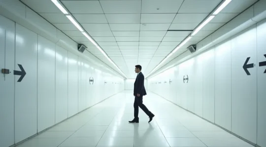
Navigating the PATH: How to Walk from Union to Eaton Centre Without Getting Lost?
The secret to Toronto’s PATH is realizing it’s not one system, but a patchwork of 35 different “kingdoms” under one roof, each with its own rules. Navigation fails when you rely on a single tool; a hybrid strategy using above-ground…
Read more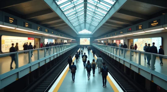
Toronto Subway Guide: Master the TTC’s Lines 1 & 2 Like a Local
In summary: Choose your side of Line 1 (University vs. Yonge) based on your final destination and time of day to avoid chokepoints. Survive rush hour at major interchanges like Bloor-Yonge by mastering “interchange choreography”—knowing where to stand on the…
Read more
Riding the Red Rocket: An Operator’s Guide to Navigating Toronto’s Streetcar System
Riding a Toronto streetcar efficiently isn’t about the route map; it’s about understanding the hidden operational logic that governs the system. The King Street transit-first rules aren’t just for cars; they are the primary reason the 504 is the most…
Read more
Guided Tours in Toronto: A Curator’s Guide to Choosing Your Perfect Walk
Choosing the right Toronto tour is less about the subject and more about matching the tour’s narrative style to the experience you crave. “Free” tours have a hidden cost, while dedicated ghost tours offer vastly different styles of fear, from…
Read more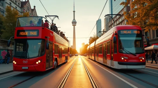
Toronto Hop-On Hop-Off: Is the $50 Ticket Worth It for Transit-Savvy Travelers?
The Toronto Hop-On Hop-Off bus isn’t a transportation service; it’s a curated sightseeing experience with a premium price tag. It offers convenient, narrated views of core downtown sights but suffers from long 2-hour wait times and significant traffic delays. Toronto’s…
Read more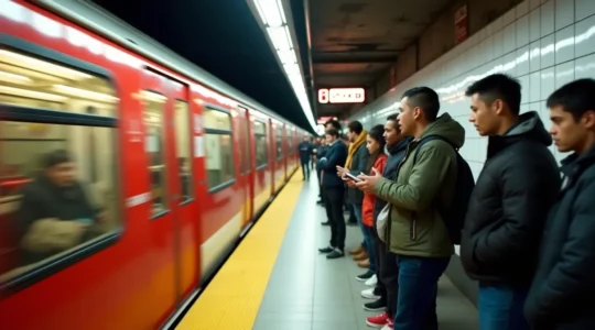
Mastering the TTC: How to Navigate the “Red Rocket” Network Like a Local
In summary: Anticipate “predictable failures” like signal problems and weekend closures instead of just reacting to them. Use low-tech solutions like SMS bus alerts and screenshotting routes to survive data-free dead zones. Understand the unwritten rules of commuter etiquette, especially…
Read moreA Newcomer’s Guide to Toronto Transit: Navigating TTC, Uber, and GO Like a Local
The key to navigating Toronto isn’t just knowing the transit options, but mastering the “Transit Decision Matrix” to choose the right mode based on cost, time, and context. A PRESTO card becomes cheaper than cash or credit taps after just…
Read more
Business Travel to MTCC: How to Survive a 3-Day Conference Without Leaving the Building?
The key to a successful conference at the Metro Toronto Convention Centre is treating the MTCC, the PATH, and Union Station as a single, self-contained indoor city. Mastering indoor navigation between buildings and transit hubs eliminates weather-related delays and stress….
Read more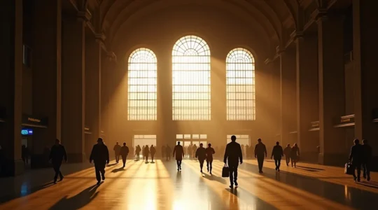
Living in the GTA: Is the Commute to Union Station Worth the Savings?
The decision to commute in the GTA isn’t a simple choice; it’s a daily logistical puzzle where hidden costs and time-sinks often matter more than the sticker price. Taking the GO Train can save over $300 CAD per month, but…
Read more