The secret to Toronto’s PATH is realizing it’s not one system, but a patchwork of 35 different “kingdoms” under one roof, each with its own rules.
- Navigation fails when you rely on a single tool; a hybrid strategy using above-ground maps and underground apps is essential.
- Timing is everything. Avoiding the 8 AM and 5 PM “suit rush” and knowing which sections lock down after hours is non-negotiable.
Recommendation: Think like a diplomat, not a tourist. Use building lobbies as checkpoints, trust the new TO360 landmark signs over the old color codes, and always have a street-level exit in mind.
There’s a moment every Torontonian, new and old, experiences: that sinking feeling of being utterly lost in the PATH. You followed a sign for the Eaton Centre, took a confident left at a food court, and now you’re staring at a locked door to a dental office in a silent, empty corridor. You check your phone. No GPS. Welcome to Toronto’s 30-kilometre underground labyrinth, a climate-controlled lifesaver in winter and a baffling maze year-round. Many guides will give you the same tired advice: “follow the signs” or “just use the map.” They mean well, but this advice fails to grasp the system’s fundamental, charming chaos.
The truth is, the PATH isn’t a single, cohesive walkway. It’s a collection of tunnels and basements controlled by over 35 different corporations. But what if the key to mastering it wasn’t about memorizing a flawless route, but about understanding this ‘feudal’ logic? What if you could learn to read the system’s inconsistencies and turn its quirks to your advantage? This isn’t just a set of directions; it’s a new mindset for navigating Toronto’s underground city. By understanding why the signs change, why some doors lock, and why one concourse feels like a different world from another, you can finally walk from Union Station to the Eaton Centre with the cool confidence of a seasoned local.
For those who prefer a visual introduction, the following video offers a great immersion into the landscapes and atmosphere of this unique underground world, perfectly complementing the practical advice in this guide.
This guide is structured to turn you from a lost pedestrian into a PATH cartographer. We’ll decode the signage, find the best lunch spots, outsmart the rush hour crowds, and understand the logic behind the system’s most confusing junctions. Let’s begin the expedition.
Contents: A Cartographer’s Guide to Toronto’s Underground City
- Why the Compass Arrows (N, S, E, W) Are Your Only Hope?
- How to Find the Best Cheap Lunch in the Financial District Tunnels?
- Google Maps vs. PATHMap: Which App Actually Works Underground?
- The Wrong Turn That Leads You to a Locked Office Tower
- When to Walk the PATH to Avoid the “Suit Rush” at 8:Dinosaur Hunting at the ROM: Which Fossil Exhibits Will Impress Your Kids the Most?
- Why the North and South Buildings Are Confusingly Separated?
- Why the Bay and York Concourses Are Separate Ecosystems?
- Toronto Shopping Guide: How to Balance Mall Brands with Local Boutiques?
Why the Compass Arrows (N, S, E, W) Are Your Only Hope?
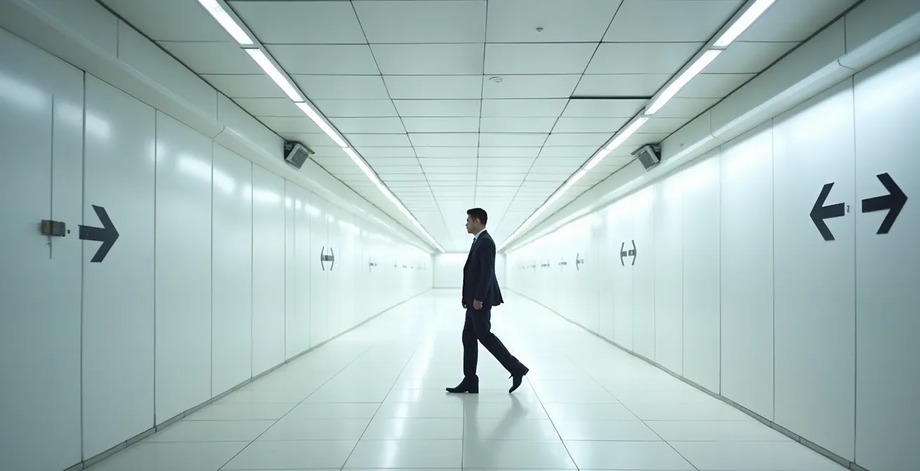
For years, the color-coded compass arrows were the gospel of PATH navigation. Red for South, Blue for North, Yellow for East, and Orange for West. In theory, a perfect system. In practice, it was a source of great confusion. The core issue lies in the PATH’s “patchwork kingdom” nature: each property owner was responsible for their own signage, leading to inconsistent lighting, placement, and sometimes, outright missing signs. This is why a perfectly clear blue “North” arrow in one tower can lead to a dimly lit, signless junction in the next.
This long-standing problem led to a comprehensive update of the PATH’s wayfinding system. The new design, part of the city-wide TO360 mapping project, is slowly phasing out the sole reliance on compass colors. It now prioritizes landmarks and neighbourhoods, which is a far more intuitive approach for pedestrians. However, the rollout is ongoing, and for now, you exist in a hybrid world. The old compass arrows are still your most reliable tool in older, un-renovated sections, acting as a baseline direction. But your *true* hope is to combine them with the new system.
The successful navigator’s strategy is to use the compass arrows for general direction but to trust the building directories and new TO360 signs at major intersections for specific turns. Look for the recognizable PATH logo to confirm you’re on the right track, but treat each building as a new territory with its own map. This mindset shift—from blindly following one system to actively cross-referencing two—is the first step to mastering the maze.
How to Find the Best Cheap Lunch in the Financial District Tunnels?
Navigating the PATH at midday presents a new challenge: finding a good, affordable lunch without getting swallowed by the crowds. The Financial District is not known for being cheap, but its underground food courts hide some surprisingly good value if you know where and when to look. The three main hubs—Union Station’s York Concourse, Brookfield Place, and First Canadian Place—each have a distinct personality and price point.
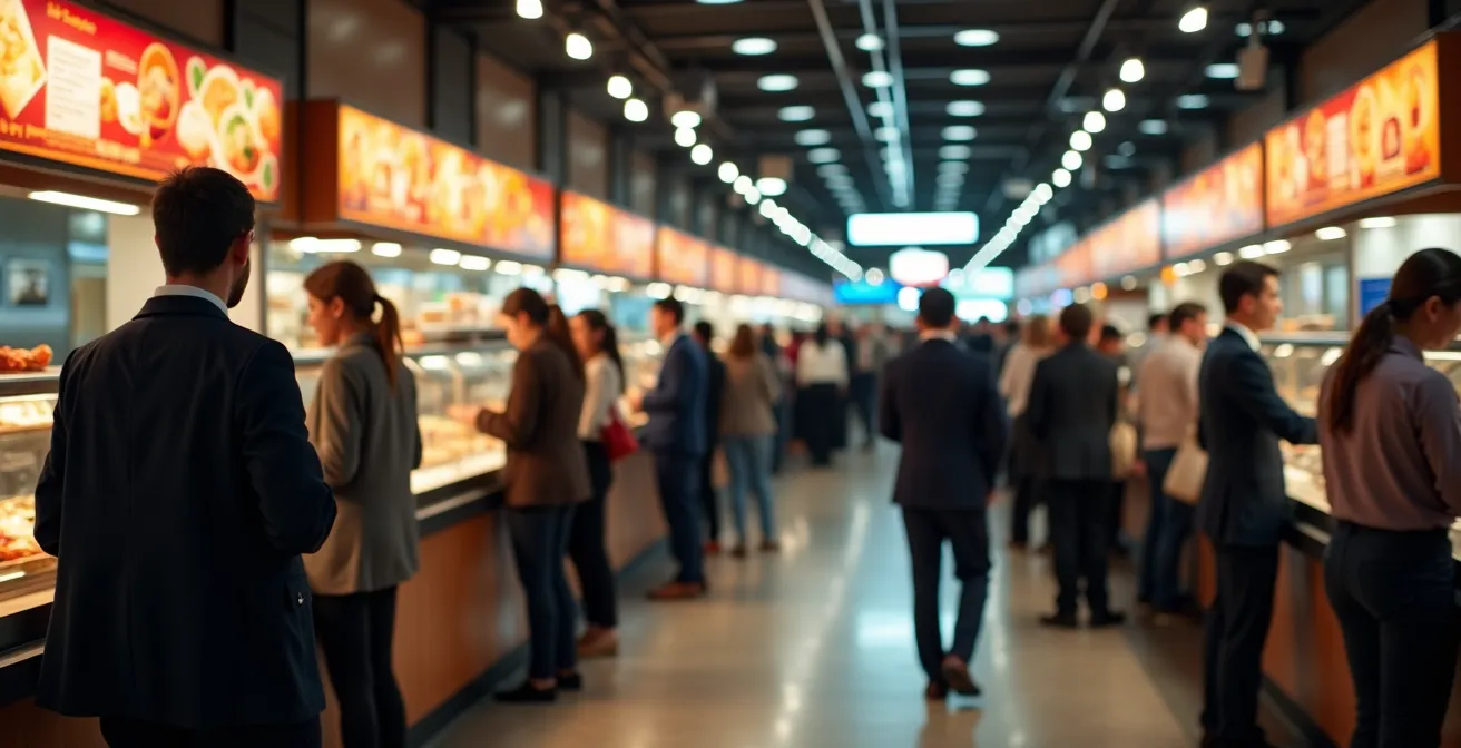
As you can see, the lunch rush is a real phenomenon. To navigate it, timing is key. The major food courts become incredibly busy between 12:00 PM and 1:30 PM. If your schedule is flexible, aiming for lunch at 11:30 AM or after 1:45 PM can mean the difference between a relaxed meal and a frantic search for a seat. For those seeking the best value, the sprawling food court at Union Station’s York Concourse offers the widest range of options, including local Toronto favourites alongside international chains.
This side-by-side comparison shows the trade-offs between the major food court players.
| Food Court | Size & Seating | Price Range | Best For | Avoid Times |
|---|---|---|---|---|
| Union Station York Concourse | 25,000 sq ft, 600 seats | $8-15 average meal | Local Toronto gems like Loaded Pierogi, Roywoods Caribbean | 5-6 PM weekdays (GO Train rush) |
| Brookfield Place | Multiple levels | $12-20 average meal | Upscale options, Allen Lambert Galleria ambiance | 12:15-1:15 PM weekdays |
| First Canadian Place | Central location | $10-15 average meal | Quick access from multiple PATH routes | 12:00-1:30 PM weekdays |
But the real secrets lie beyond the big three. Tucked away in smaller nooks are legendary local spots that offer incredible food for less. Don’t be afraid to wander into the less-trafficked corridors of places like the Atrium on Bay or the Front Street Promenade. These hidden gems are where you’ll find the authentic Toronto lunch experience:
- Uno Mustachio at Atrium on Bay: A legendary spot for a veal sandwich under $12.
- Kupfert & Kim (multiple locations): The go-to for healthy, wheatless, and meatless bowls.
- Amano at Union Station: Famous for its $1/oz house wine happy hour on weekdays.
- Danish Pastry House at Front Street Promenade: Perfect for authentic Scandinavian baked goods and light lunches.
Google Maps vs. PATHMap: Which App Actually Works Underground?
The classic rookie mistake: pulling out your phone underground, opening Google Maps, and watching helplessly as your blue dot drifts into an existential void. GPS signals cannot penetrate the layers of concrete and steel above you, rendering most standard navigation apps useless. This has created a market for specialized apps, but which one can you actually trust?
The battle for underground supremacy is mainly between Google Maps’ fledgling indoor mapping and dedicated apps like PATHMap. While Google is excellent for getting you to the correct building entrance from the street, its performance once you descend is notoriously unreliable. It relies on a patchwork of Wi-Fi and Bluetooth beacons that are inconsistently maintained by the various property owners. A user study found that this “Hybrid Strategy”—using Google Maps above ground and a dedicated app below—is the most effective method. The study showed a 90% success rate for the hybrid approach, compared to just 60% for those who relied on a single app.
So, what should be your go-to app once you’re in the tunnels? Here’s how the main options stack up.
| Feature | Google Maps Indoor | PATHMap App | PDF Official Map |
|---|---|---|---|
| Works Offline | No | Yes (after download) | Yes |
| Real-time Location | Fails underground | Limited accuracy | None |
| Turn-by-turn Directions | Yes (when working) | Yes with premium ($3.99/year) | No |
| Updated Frequency | Irregular | Monthly | Annually |
| Best Use Case | Finding building entrances above ground | Navigation with visual landmarks | Backup when apps fail |
The consensus among seasoned PATH walkers is clear. Use Google Maps to find your entry point (e.g., “Royal Bank Plaza PATH entrance”). Once inside, switch to a downloaded PDF of the official map or an app like PATHMap for visual navigation. These tools won’t show your real-time location with perfect accuracy, but they provide the reliable, static map you need to make decisions at junctions, treating the system like a classic video game map rather than a modern GPS route.
The Wrong Turn That Leads You to a Locked Office Tower
It’s 6:30 PM on a weekday, or maybe a quiet Saturday afternoon. You’re navigating the PATH, and suddenly, the sparse crowds disappear entirely. The lighting dims, the air stills, and you arrive at a set of immaculate glass doors that won’t budge. You’ve found one of the PATH’s many dead ends. This isn’t a design flaw; it’s a feature of its multi-owner system. Many connections run through private office towers that lock down after business hours.
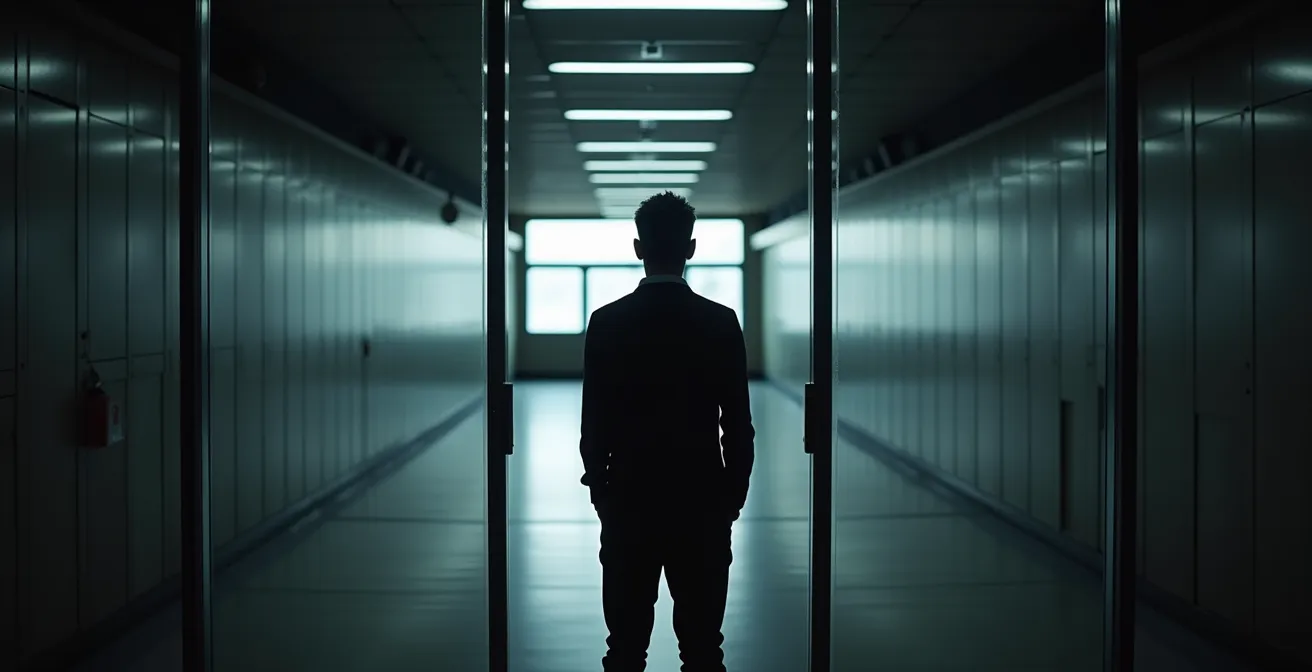
This is the most common trap for visitors and even locals. The main arteries of the PATH connecting major hubs like Union Station and the Eaton Centre generally stay open later, but the smaller veins branching off into corporate buildings do not. In fact, data on the system reveals that over 40% of PATH sections have limited hours, with most office tower connections closing after 6 PM on weekdays and remaining locked on weekends. This directly answers the common question: the PATH is not a 24-hour system. Its accessibility is a mosaic that changes by the hour.
So what do you do when you hit that inevitable wall? Don’t panic. Getting lost is a rite of passage, but getting un-lost is a skill. Follow this simple recovery protocol.
Your 5-Step Recovery Plan for a PATH Wrong Turn
- Find a Directory or Guard: Your first step should be to backtrack to the nearest building directory or security desk. Guards are accustomed to lost souls and can quickly point you in the right direction.
- Locate an “Escape Hatch”: Look for the green “EXIT” signs. These are your escape hatches to street level. Getting above ground is the fastest way to re-orient yourself.
- Use Above-Ground Landmarks: Once on the street, find a major landmark like the CN Tower or Scotia Plaza. This will give you an immediate sense of north, south, east, and west.
- Re-enter at a Major Hub: Don’t try to re-enter the PATH from a small, unmarked door. Walk to a major hub like Union Station, the Eaton Centre, or Brookfield Place, which have much clearer signage.
- Take a Photo: Before you descend again, take a quick photo of the “You Are Here” map in the main lobby. It will be your best friend if your app fails again.
The key is to accept that you will make a wrong turn. Viewing it as part of the experience and having a plan to recover is what separates the novice from the master.
When to Walk the PATH to Avoid the “Suit Rush” at 8:Dinosaur Hunting at the ROM: Which Fossil Exhibits Will Impress Your Kids the Most?
Beyond getting lost, the biggest challenge of the PATH is managing the human traffic. At certain times, the main corridors transform from a pleasant walkway into a relentless human river, a phenomenon locals call the “suit rush.” This is the mass migration of Financial District office workers commuting to and from Union Station. Walking against this tide is not for the faint of heart. Understanding the daily ebb and flow is crucial for a stress-free journey.
The peak rush hours are predictable. The morning rush is a powerful northbound current flowing from Union Station into the office towers, while the evening rush is an equally intense southbound flood heading back to the GO Trains and subway. Tourists or casual pedestrians attempting to shop or stroll during these times will find the experience overwhelming. The unofficial “express lanes” that form in the middle of corridors are particularly unforgiving.
For a peaceful journey, the golden hours are mid-morning (10:00 AM to 11:30 AM) and mid-afternoon (2:00 PM to 4:00 PM). During these times, traffic is light and mixed, allowing for leisurely exploration and shopping.
| Time Period | Traffic Level | Direction Flow | Best For |
|---|---|---|---|
| 8:00-9:30 AM | Very High | Northbound from Union | Avoid if tourist |
| 10:00-11:30 AM | Low | Mixed | Tourist exploration |
| 12:00-1:30 PM | High | Food courts packed | Shopping only |
| 2:00-4:00 PM | Low | Mixed | Peaceful exploration |
| 4:30-6:00 PM | Very High | Southbound to Union | Avoid completely |
Navigating the crowds also involves social etiquette. To blend in and avoid causing a human traffic jam, follow these unwritten rules:
- Keep Right, Walk Left: Just like on the highway, slower traffic should stay to the right to allow others to pass on the left.
- No Sudden Stops: If you need to check your phone or a map, pull over to the side. Stopping abruptly in the middle of a corridor is a major faux pas during rush hour.
- Respect the Express Lane: During peak times, the center of wide corridors becomes an unofficial fast lane. Don’t meander here.
- Escalator Etiquette: A sacred Toronto rule—stand on the right, walk on the left.
- Doorway Courtesy: Always let people exit a doorway or narrow passage before you enter, especially at bottleneck points near subway entrances.
Why the North and South Buildings Are Confusingly Separated?
Nowhere is the PATH’s potential for confusion more potent than at its very heart: Union Station. Recent massive renovations, known as the Dig Down project, have transformed the station but also created a significant navigation challenge: the “Great Divide” between the Bay Concourse and the York Concourse. Many first-timers get this wrong and end up heading south toward Scotiabank Arena instead of north into the Financial District’s PATH network.
The confusion stems from the fact that these two concourses, while both part of Union Station, were redeveloped to serve different primary purposes. The Bay Concourse on the east side is the main hub for GO Train commuters, designed for quick access to platforms and grab-and-go food options. The York Concourse on the west side, however, is the true gateway to the PATH. It houses the massive new food court and, most importantly, provides the main indoor entrance to the Financial District through the doors of the Royal Bank Plaza.
Getting this right is the single most important step in a successful journey from Union to the Eaton Centre. If you get off a GO Train, you must resist the instinct to follow the largest crowds and instead consciously navigate toward the York Concourse. From there, your mission is to find the PATH entrance in the concourse’s northwestern corner.
To make it foolproof, here is the three-step process for a successful transition from your train to the PATH:
- Exit to York Concourse: After disembarking your GO Train or VIA Rail train, follow all overhead signs for “York Concourse.” Ignore signs for Bay Concourse or the TTC subway for now.
- Find the Northwest Corner: Once in the main York Concourse hall, look for the PATH entrance located near the northwestern corner. It will often be signed for Royal Bank Plaza.
- Enter and Follow the Blue: Go through the doors into Royal Bank Plaza. You are now officially in the PATH. Look for the first blue “North” arrows or TO360 signs pointing you toward the Financial District and your eventual destination.
Why the Bay and York Concourses Are Separate Ecosystems?
Understanding that the Bay and York concourses are physically separate is the first step. Understanding that they are functionally different ecosystems is the key to navigating them like a pro. This separation isn’t accidental; it’s a deliberate design to manage the immense flow of people passing through Union Station every day. It is the busiest transportation facility in Canada, a nexus connecting six subway stations and serving both GO Transit and VIA Rail passengers.
The Bay Concourse is a pure commuter ecosystem. Its design is optimized for speed and efficiency. The retail offerings are dominated by quick-service coffee shops like Tim Hortons and grab-and-go food stalls. It provides the most direct access to the TTC subway platforms, catering to people making a rapid transfer from a regional train to the local transit system. It is a space of purpose and movement, not a place to linger.
The York Concourse, in contrast, is a destination ecosystem. While it also serves commuters, its design encourages people to pause. It is home to the new 25,000-square-foot food court with ample seating, a wider variety of sit-down and specialty food vendors, and a more relaxed atmosphere. Crucially, it serves as the grand entrance hall to the PATH system for the entire Financial District. It is designed to be an extension of the downtown core, a place where people meet, eat, and begin their underground journey. City of Toronto data shows that over 200,000 daily commuters use the PATH system, and this concourse is engineered to be their primary starting point.
By recognizing these distinct roles, you can make smarter decisions. If you need to quickly catch the subway, head for Bay. If you want to grab lunch, meet a colleague, or start a walk to the Eaton Centre, York is your target. Treating them as two different places, not two sides of the same place, is the final piece of the Union Station puzzle.
Key Takeaways
- The PATH is not one system; it’s 35+ connected properties. Navigate by building, not by the entire map.
- A “Hybrid Strategy” is essential: Use Google Maps above ground to find your entrance, then a dedicated app or PDF map once underground.
- Timing is critical. Avoid the 8-9:30 AM and 4:30-6:00 PM “suit rush” and be aware that many sections close after 6 PM and on weekends.
Toronto Shopping Guide: How to Balance Mall Brands with Local Boutiques?
The journey from Union Station to the Eaton Centre is more than just a commute; it’s one of Toronto’s most unique shopping experiences. The PATH is essentially a 3.7 million square foot retail space, a sprawling underground marketplace where you can find everything from luxury watches to a last-minute birthday card. The challenge for a savvy shopper is to look beyond the major mall brands and discover the local boutiques and specialty shops that give the PATH its character.
A successful PATH shopping trip involves a strategy of “layering.” You start with the high-traffic, big-brand areas and progressively work your way into the quieter corridors where independent retailers thrive. This allows you to balance the convenience of major chains with the discovery of unique Toronto artisans. The system is a massive economic engine, with its 1,200 shops and services generating significant annual sales, but its real charm is in the diversity of its offerings.
Here is a sample underground shopping tour that balances the big names with local finds, taking you from south to north:
- Start at Scotiabank Arena: The area connecting to Union Station is ground zero for sports fans, with team gear and merchandise for the Raptors and Maple Leafs.
- Browse Royal Bank Plaza: As you enter the Financial District proper, the shops become more business-oriented. This is the place for high-end pens, leather goods, and corporate accessories.
- Explore Brookfield Place: Known for its stunning Allen Lambert Galleria, this section offers a mix of luxury brands and upscale fashion.
- Check TD Centre and First Canadian Place: Keep an eye out for pop-up shops. These towers often feature temporary kiosks from local Toronto artisans, offering everything from handmade jewelry to gourmet chocolates.
- Finish at CF Toronto Eaton Centre: Your journey culminates at one of Canada’s premier shopping malls, where you’ll find all the major international retail brands and department stores like Hudson’s Bay and Nordstrom.
By following a route like this, you experience the full spectrum of the PATH’s retail ecosystem. You can accomplish your practical shopping at the major hubs while leaving room for the serendipitous discovery of a local gem tucked away in a quiet corridor. That balance is the art of shopping the PATH.
With this cartographer’s guide in hand, you’re now equipped not just to survive Toronto’s PATH, but to master it. So next time you descend those stairs at Union Station, do it with confidence, ready to explore the underground city.
Frequently Asked Questions About Navigating Union Station
Which concourse should I use for the TTC subway?
Bay Concourse provides the most direct access to the TTC subway platforms.
Where is the main PATH entrance to the Financial District?
York Concourse offers the primary PATH entrance through Royal Bank Plaza to reach the Financial District.
Which concourse has the new food court?
York Concourse houses the new 25,000 square foot food court with 10 eateries and 600 seats on the lower level.